
Town of Hanson Conservation Recreation Areas-Indian Crossway
Indian Crossway
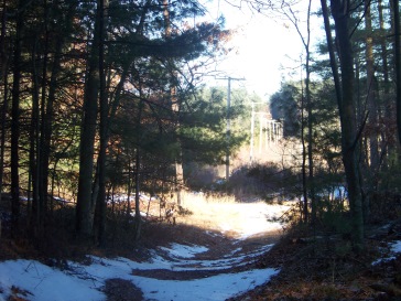
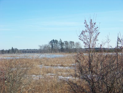
Access: Going east on Main Street (Route 27) just past the Hanson Police Station turn left onto Crooker Place. At the end of the street you will cross over the commuter rail line and will find a small parking area immediately to the left. (Please respect the private property and residences in this area). At the parking area you will see a Fire Road Gate and just beyond that a Kiosk (there is no information currently posted on the Kiosk). Follow this marked trail through the woods and out to view of the Cedar Swamp and Burrage Pond Reservoirs and eventually out to Elm Street.
The Indian Crossway through the Burrage Pond Wildlife Area is part of the ancient trail used by the Native Americans in the what is now the Taunton River and North River watershed areas. The trail was a route between these two watershed areas that roughly followed from Indian Head Pond along what is now Main Street in Hanson, to Crooker Place and through the Great Cedar Swamp highlands and out to what is now the Smith-Nawazelski Conservation Area and on to East Bridgewater and the Taunton River Watershed lands. The trail that begins at Crooker Place is part of the Bay Circuit Trail and is the only remaining “undeveloped” part of the ancient trail.
Note: the trail description below is available in its full unedited text and pictures on the link below:
https://www.south-shore-hiking-trails.com/hiking-trails-hanson-indian-cr...
| Attachment | Size |
|---|---|
| 62.04 KB | |
| 57.21 KB | |
| 3.21 MB | |
| 895.63 KB | |
| 18.6 KB |